Rare lichens, remote research and AI habitat mapping – how new technologies are making conservation more efficient.
Ecologist James Bunyan is closely examining a small patch of lichen on the dunes just outside Findhorn. That’s remarkable for two reasons: first, that some of these lichens are found in only a few other places in the world, and second, that he’s actually sitting on the Black Isle, about 50 miles away.
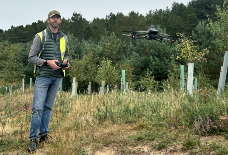
James, of Tracks Ecology Ltd, is using two technological advances – high resolution drone photography and GIS (Geographical Information Systems) digital mapping – to monitor the pioneering restoration experiment taking place on our dunes.
Importantly, the results have the speed, efficiency and scale that would be impossible to achieve by a human on foot.
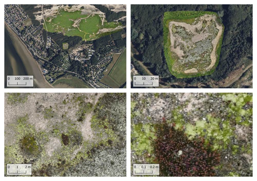
The detail is astonishing. From an image of the Findhorn peninsula, James zooms in to show the Hinterland, then an area of gorse, then a small patch of heather, with the tiny individual flowers clearly visible. He settles on a stone, which he then measures (it’s 12 centimetres long).
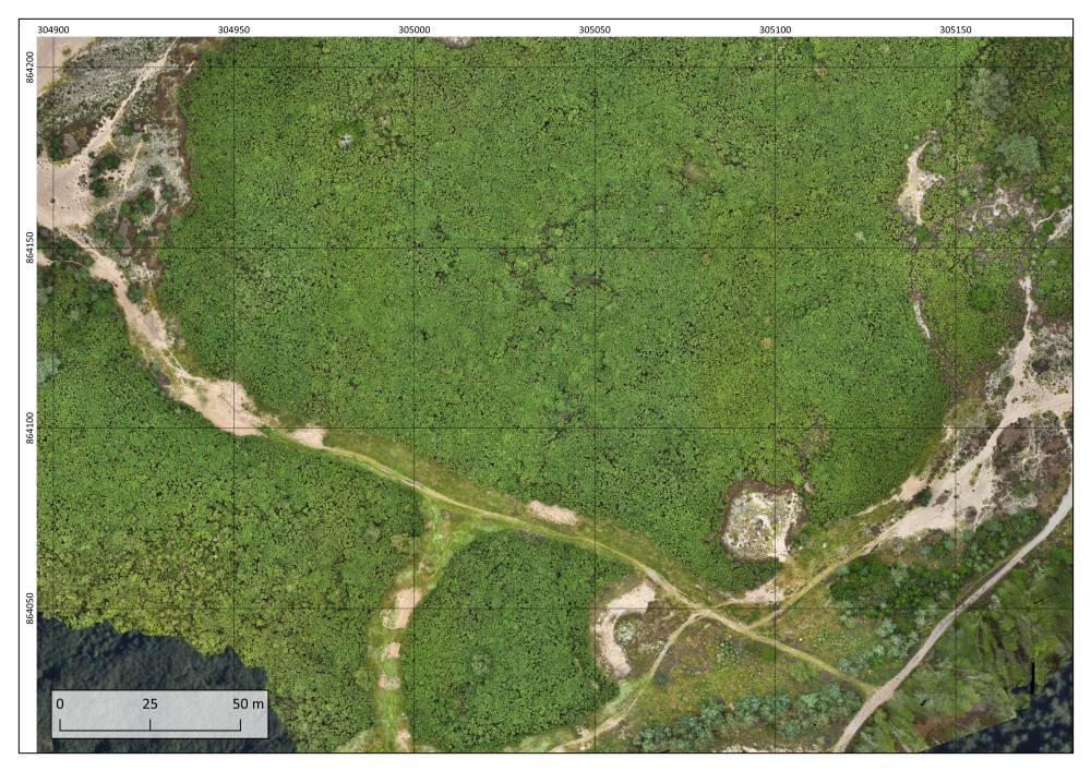
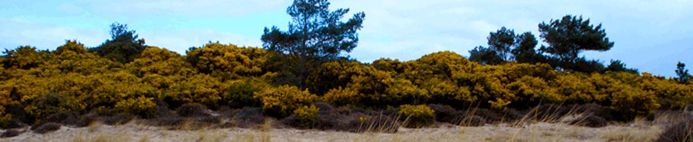
In September 2024 he used his drone to photograph the area of gorse earmarked for the dune restoration project. A second drone flight in November captured baseline images of the newly cleared dune, bare sand that will hopefully over time develop the wild ecosystem that was once part of the second largest sand dune system in Europe, of which only small fragments now remain.
 Repeat flights at intervals over the coming months and years will monitor the changes and progressions – literally giving us the big picture of how the site develops over time.
‘Before the advent of drones, monitoring and mapping how habitats change with precision was very difficult,’ says James. ‘Not so long ago it involved ecologists out with pencils, paper and maps, which could potentially impact delicate habitats and disturb protected species. The results could be subjective and involve significant errors. So drones and GIS make the information-gathering process that much more robust.’
This technology is particularly useful because dune habitats are mobile – the wind blows and the dunes move. This is why too much gorse becomes a problem: it stabilises the dunes, squeezing out the precious dune habitats. ‘With an aerial view we can more easily measure changes in sand dunes, where sand is accumulating, and where it’s eroding.’
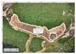
The high resolution imagery offers another advantage: it can show exactly which vegetation is returning, and whether this dune restoration approach is succeeding in fostering the habitats and super-rare species that are critically endangered. At Heathneuk, just outside Findhorn village, the lichens are being monitored on a site that was cleared four years ago. This small area was mapped with very high resolution, with each pixel measuring 3 millimetres, allowing you to zoom in to sub-centimetre level.
(Pixels are the square blocks you see when you zoom right in on an image. The smaller the pixels – or the number of pixels in an image – the more detail you can see.)
This is where machine learning, a useful branch of Artificial Intelligence, can come into play. ‘With machine learning, we can use computers to identify species, by training them to analyse and recognise what a particular pixel is.
‘There are different ways to do this – you can either teach it to recognise objects, such as invasive species like rhododendrons, or to recognise pixels. For example, we are mapping seagrass in intertidal zones based on the differences in the colour of the sand, which show where the sea grass is. That would obviously be impossible on foot. It’s also more robust, more easily repeatable, and far quicker than on-the-ground work.’
Technology can also create 3D models of the land, as you can see in this ‘fly-through’ of the dune restoration area.
Data captured from a drone with a LiDAR sensor or optical camera can be used to create a 3D model of the landscape or object, by collecting data points mapped in three dimensions (a point cloud). The process of photogrammetry matches thousands of recognisable points in at least four separate, overlapping images. The accurate three-dimensional location of each of these points can then be calculated, with the composite of all points forming the point cloud, a 3D model.
There are other very down-to-earth benefits. The Hinterland Trust works with educational groups like the Forres Academy, and now learners can see the land’s full scale (even when it’s raining). Plus, being able to offer visible proof of habitat restoration successes at scale will be invaluable in securing grant funding for the ongoing conservation of the land.
Working with lichen expert Heather Paul, James is trialling whether machine learning can be used to map lichen in small areas – 60 by 60 metres – from the very high resolution imagery. ‘In addition to optical data, like the red-green-blue that our eyes see, we can gather multispectral info, in other words beyond the spectral range of human vision. This gives machine learning more data to train with – additional info to help with identification. This is the beginning of a journey – we may in time be able to identify if not actual species, then species types and certainly habitats.’
James is working with the Findhorn Hinterland Trust as he’s on a mission to improve the technologies used in ecological consulting and conservation. ‘This is a testing ground for new approaches and I want to get the technology understood more widely. And I believe it can really contribute to the Hinterland’s success.’
This high resolution habitat mapping, plus using GIS to also analyse and store the data gathered by others in the Hinterland Trust team, such as Neil Miekleham and Alan Watson Featherstone, creates an accurate image of what’s happening in the Hinterland right now, as well as an invaluable resource and record of the land, to be handed on through time.


Lichen spotting – at 50 miles
Rare lichens, remote research and AI habitat mapping – how new technologies are making conservation more efficient.
Ecologist James Bunyan is closely examining a small patch of lichen on the dunes just outside Findhorn. That’s remarkable for two reasons: first, that some of these lichens are found in only a few other places in the world, and second, that he’s actually sitting on the Black Isle, about 50 miles away.
James, of Tracks Ecology Ltd, is using two technological advances – high resolution drone photography and GIS (Geographical Information Systems) digital mapping – to monitor the pioneering restoration experiment taking place on our dunes.
Importantly, the results have the speed, efficiency and scale that would be impossible to achieve by a human on foot.
The detail is astonishing. From an image of the Findhorn peninsula, James zooms in to show the Hinterland, then an area of gorse, then a small patch of heather, with the tiny individual flowers clearly visible. He settles on a stone, which he then measures (it’s 12 centimetres long).
In September 2024 he used his drone to photograph the area of gorse earmarked for the dune restoration project. A second drone flight in November captured baseline images of the newly cleared dune, bare sand that will hopefully over time develop the wild ecosystem that was once part of the second largest sand dune system in Europe, of which only small fragments now remain.
‘Before the advent of drones, monitoring and mapping how habitats change with precision was very difficult,’ says James. ‘Not so long ago it involved ecologists out with pencils, paper and maps, which could potentially impact delicate habitats and disturb protected species. The results could be subjective and involve significant errors. So drones and GIS make the information-gathering process that much more robust.’
This technology is particularly useful because dune habitats are mobile – the wind blows and the dunes move. This is why too much gorse becomes a problem: it stabilises the dunes, squeezing out the precious dune habitats. ‘With an aerial view we can more easily measure changes in sand dunes, where sand is accumulating, and where it’s eroding.’
The high resolution imagery offers another advantage: it can show exactly which vegetation is returning, and whether this dune restoration approach is succeeding in fostering the habitats and super-rare species that are critically endangered. At Heathneuk, just outside Findhorn village, the lichens are being monitored on a site that was cleared four years ago. This small area was mapped with very high resolution, with each pixel measuring 3 millimetres, allowing you to zoom in to sub-centimetre level.
(Pixels are the square blocks you see when you zoom right in on an image. The smaller the pixels – or the number of pixels in an image – the more detail you can see.)
This is where machine learning, a useful branch of Artificial Intelligence, can come into play. ‘With machine learning, we can use computers to identify species, by training them to analyse and recognise what a particular pixel is.
‘There are different ways to do this – you can either teach it to recognise objects, such as invasive species like rhododendrons, or to recognise pixels. For example, we are mapping seagrass in intertidal zones based on the differences in the colour of the sand, which show where the sea grass is. That would obviously be impossible on foot. It’s also more robust, more easily repeatable, and far quicker than on-the-ground work.’
Technology can also create 3D models of the land, as you can see in this ‘fly-through’ of the dune restoration area.
Data captured from a drone with a LiDAR sensor or optical camera can be used to create a 3D model of the landscape or object, by collecting data points mapped in three dimensions (a point cloud). The process of photogrammetry matches thousands of recognisable points in at least four separate, overlapping images. The accurate three-dimensional location of each of these points can then be calculated, with the composite of all points forming the point cloud, a 3D model.
There are other very down-to-earth benefits. The Hinterland Trust works with educational groups like the Forres Academy, and now learners can see the land’s full scale (even when it’s raining). Plus, being able to offer visible proof of habitat restoration successes at scale will be invaluable in securing grant funding for the ongoing conservation of the land.
Working with lichen expert Heather Paul, James is trialling whether machine learning can be used to map lichen in small areas – 60 by 60 metres – from the very high resolution imagery. ‘In addition to optical data, like the red-green-blue that our eyes see, we can gather multispectral info, in other words beyond the spectral range of human vision. This gives machine learning more data to train with – additional info to help with identification. This is the beginning of a journey – we may in time be able to identify if not actual species, then species types and certainly habitats.’
James is working with the Findhorn Hinterland Trust as he’s on a mission to improve the technologies used in ecological consulting and conservation. ‘This is a testing ground for new approaches and I want to get the technology understood more widely. And I believe it can really contribute to the Hinterland’s success.’
This high resolution habitat mapping, plus using GIS to also analyse and store the data gathered by others in the Hinterland Trust team, such as Neil Miekleham and Alan Watson Featherstone, creates an accurate image of what’s happening in the Hinterland right now, as well as an invaluable resource and record of the land, to be handed on through time.